On a frosty, early February morning with snow in the mountains, I set out on my walk along the banks of the River Moy in Ballina from the Salmon Weir Bridge to the Quay, passing along my route reminders of an unfinished canal that Georgian-era visionaries dreamed would link the town to Lough Conn.
It might seem like a grandiose plan today, but, two hundred years ago, work was underway to create a navigable waterway for cargo boats between the River Moy estuary and Ballina town centre; and, an even more ambitious plan, to construct a canal all the way to Lough Conn also won the support of the civic and commercial society of the day.
The year was 1822 when canal building was booming throughout Britain and Ireland and the railway’s potential for moving freight and people had yet to be fully realised.
To quote Charles Dickens, in A Tale of Two Cities: “It was the best of times, it was the worst of times …” as Ballina, then a fast-developing market, manufacturing and milling town, sought to crown its prosperity and growing commercial importance by announcing grand plans to build impressive streetscapes, roads and bridges that 200 years on continue to serve the town well.
One of the leading Ballina merchants of the early 19th century is credited as being the early driving force behind the plan to open up the Moy to navigation and, over the years, the proposal won the support of public representatives, the Governor of Mayo, George Jackson of Enniscoe, and commercial interests and bishops.
According to Samuel Lewis’ Topographical Dictionary (1837): “A very extensive tobacco and snuff manufactory was established in 1801, by Mr. Malley, who first persevered in opening the navigation of the river Moy, and thus gave a powerful impulse to the commercial prosperity of the town.”
But, for the poor, the struggle to survive was becoming more critical by the day following successive potato crop failures. For those in authority, the plans for public works had both philanthropic and selfish benefits by providing employment and relief for a desperate and hungry population and quelling growing agitation that was manifesting itself in popular street protests against the injustices of rapacious landlords.
Neither the dream of making the Moy navigable from the sea to the town centre nor the canal to Lough Conn, were ever realised; both foundering as the promoters tried to negotiate the perilous waters of government. The Moy Navigation and The Lough Canal schemes eventually sunk beneath the murky swamps of bureaucracy by which time the railway’s arrival in Ballina in 1873 signalled the inevitable end of the canal era.
Enduring edifices

As I pass Ham Bridge and St. Muredach’s Cathedral, I am reminded that those early decades of the 19th century saw a building boom in the town that gave us many of Ballina’s most enduring edifices, including Ham Bridge, built by Thomas Ham in 1836; the Lower Bridge which was erected 1835 by Armstong and West; and the Cathedral completed in 1834. All part of Ballina’s built heritage is a lasting testament to those visionary engineers who set Ballina on its journey from a small market town to becoming the third biggest commercial centre in Connacht after Galway and Sligo.
The saga of the River Moy Navigation work made headlines in the local newspapers throughout the early decades of the 19th century. In an era when horsepower had yet to be replaced by steam, Ballina’s merchants rowed in behind the scheme to make the river navigable from the sea to the town centre, seeing the convenience of cargo ships docking at Bachelors Walk, and bypassing the fledgling port at the Quay, three kilometres down river.
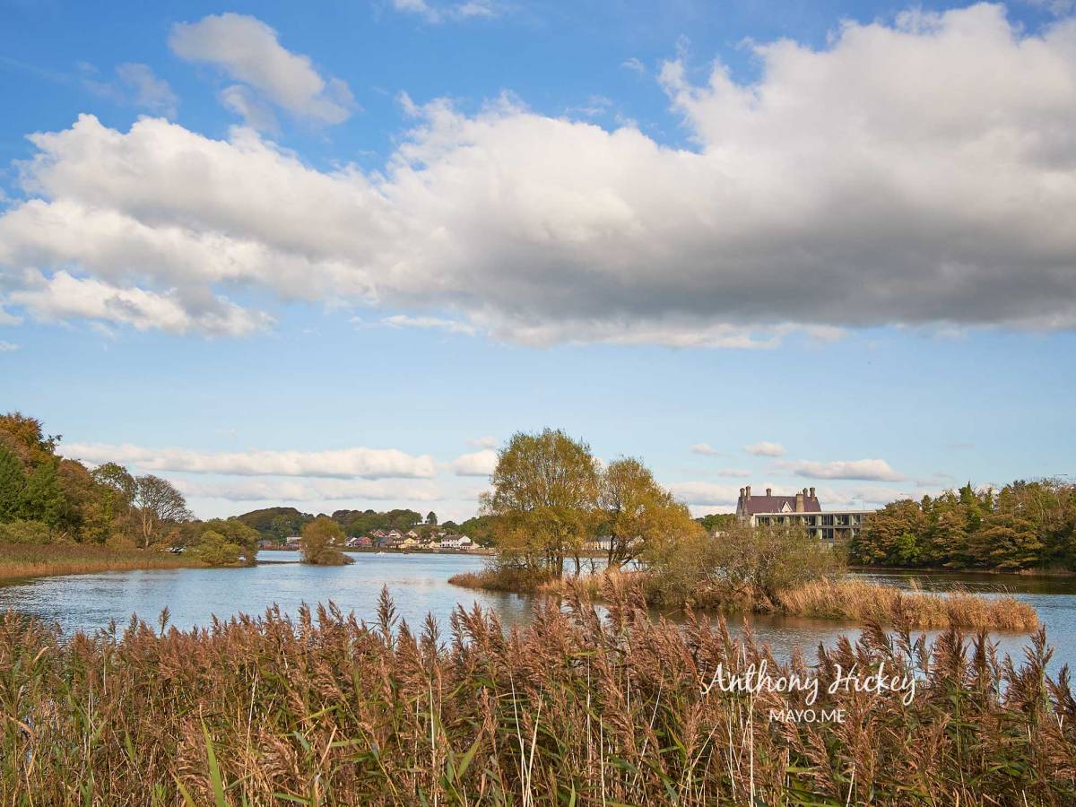
Crossing Bunree Bridge, where the Brusna River skips over rocks and falls as it rushes to meet the mighty Moy, the last tangible evidence of the unfinished River Moy Navigation scheme comes into view. It’s the first of the two docks; now overgrown, the stone banks were created to deepen a channel for cargo vessels to navigate around the silted and turbulent sections of the river. The relics are an eye-catching feature of the Moy that, thankfully, are still used by watersport enthusiasts.
Stuck upriver
Over the centuries, the docks have been reclaimed by nature and evolved into river islets and havens for wildfowl; one of the structures is located opposite the Icehouse and the second at Riverslade, just beyond the confluence of the rivers Moy and Brusna.
During the summer months, as late as the 1970s, when leisure boats were still moored below the Lower Bridge, at Bachelors Walk, or Poulnamonagh as that part of the River Moy is known, the docks were useful for town boatmen as it facilitated a safe passage when the tide was making and the obstacle of the mudflats near the Ice House were still not covered by the rising waters.
Only one vessel is recorded as sailing up through the docks from the Quay to have its cargo unloaded near the town centre.
In his book, Dear Old Ballina, the definitive history of the town, local historian and writer, Terry Reilly, tells us that a small vessel was able to negotiate the docks and discharge its cargo at the Lower Bridge.
“A Mr. Merrick, who built the block of houses which are now the site of the former Hanley’s fashion shop (Supermacs), owned a fleet of hookers and one of these said to be named “Idea” entered the Moy one morning under skipper Jimmy Kelly who was determind to put the docks to the test.
“Aided by high water, he reached Bachelors Walk after much difficulty and discharged his cargo. Perhaps because of the difficulty experienced in getting upstream, she was left there and became a playground for children. The poor of the town took away her planking to use as firewood and a Mr. Boland, erecting a premises in Bridge Street (now Healy’s) in 1849, used two of her strong oak battens as lintels over the back gate opening on to the laneway.”
Swam and played

Echoes of the unfinished River Moy canal can still be heard when Ballina people refer to the canal, meaning that section of the Moy above the weirs, behind Morrison Terrace, which also gave The Canalside Residents’ Association its appellation.
For generations of Ballina people, the canal was where they swam and played as children. As a child, I often heard older family members talk of childhood summer days spent playing and swimming in the canal.
In her lovely Ballina memoir, Beyond Nephin, about growing up in Hill Street in the 1940s, Kathleen Grehan, recalls what it was like living near the canal:
“Summer was just a great time for us; always outside playing we would go up the canal on weekends to swim in a part of the river called ‘the swimming hole’. It is a wonder we were allowed to go there in the first place, as it was the fast flowing Moy River
“The Canal was our beach resort: to go there we would make plans the day before. This involved preparing and packing our sandwiches, swimsuits, blankets and towels for the day.”
In recent decades, the Millenium Walkway, a beautiful winding trail along the banks of the Moy, from Mill Street to the Hollister factory at Rehins, has given a new lease of life to that part of the riverbank that will always be known as the canal.
National Archive

The story of the River Moy Navigation and the Lough Conn Canal schemes still resonates today in that all too familiar narrative that involves ambitious local development plans, short on political clout, getting tangled up in bureaucratic undergrowth and, in the case of the canal, being both literally and figuratively, overtaken by the unstoppable train of progress.
It’s a tale worth recalling, nonetheless, if only for a few whimsical moments to imagine “what if…?”, particularly, in light of the tourism business a canal from Ballina to Lough Conn might generate today.
Public works to improve the navigation of River Moy and open up a canal for cargo ships to the Lower Bridge began in 1822 under the supervision of a Scottish-born surveyor and engineer to the Western District, Alexander Nimmo.
The National Archive Papers for 1822-23 includes a file of papers relating to public works to improve navigation of River Moy at Ballina, incorporating a map depicting land use, river, rocks and sand beds, and woodland. Also in the repository are the layout and names of streets in Ballina. Further information, compiled by Nimmo, relates to the depth of water at various points in the river at spring tides; also information indicating land owners of areas along the river.
The archive also includes a letter from Nimmo, reporting the amount of money expended on improvements to River Moy, and estimating the amount required to complete further work. He also refers to outstanding expenses for previous relief work carried out on the river.
In his papers, Nimmo details the main improvements which have been achieved by the work under his direction, to 30 January 1823. There is also a map of ‘Plan and Section of the Moy River from the bridge of Ballina to the quay at Coonalecka’, with the works done under his direction and signed by Alexander Nimmo, C. Engineer F.R.S.E., 1822.
Lough Conn Canal

The River Moy Navigation Act was raised on a number of occasions in the House of Commons and the scheme was even recommended by a Select Committee of the Parliament in 1835. However, it was held up by procedural red tape and incompetence by the promoters’ legal agent before eventually being consigned to the history books.
An even more ambitious plan envisaged a canal all the way to Lough Conn. Lewis’ “Topographical Dictionary” (1837): reported that:
“A communication by canal to Lough Conn, and thence to Galway, has been projected by Mr. Bald, the county surveyor, which would open an abundant source of industry and wealth to the inhabitants of these mountain districts, at present inaccessible from want of roads, and greatly increase the commercial interests of the town.”
The canal to Lough Conn was to be three miles long, accessing the northern end of the lake near Gallows Hill (near Cloghans), and would connect The Moy with Loughs Conn and Cullen at an estimated cost of between ten and fifteen thousand pounds.
Undoubtedly, a canal to Lough Conn would have been a big topic of conversation in the town; arguments likely to have centred on what route would the canal take; and how would it bypass the formidable rapids at the turbulent Salmon Weirs.
We get some insight into how the plan was seen among the local population in an edition of the Connaught Telegraph of July 1835 from letter-writer “Navigator” who suggested a different route for the canal than was proposed. Boats going up the Gallows Hill route, he pointed out, would have to travel a total of 23 miles to reach the mouth of the Turlough River into Bough Cullen. From here to Turlough the river could be made into a wider canal to take larger boats for a distance of 7 miles.
“Since Turlough is three miles from Castlebar, this would make the total distance from Ballina by this route about 33 miles.”
The correspondent suggested that by making a small canal round the falls at Foxford, and, by enlarging the already existing one at the Eel Weirs at Ballina, the only obstacle remaining would be to open a passage at the Salmon Weirs, reducing the total distance to around 20 miles, and would also cut the cost considerably as well as being of great benefit to both Foxford and Ballyvary and the surrounding areas.
However, the River Moy Navigation works were never completed and the canal to Lough Conn never got off the drawing board. Over the subsequent decades, several appeals were made for further funding, citing the commercial benefits to Ballina and the need for public works to give relief to the many hungry and destitute of the district.
Today, tall reeds and trees cover the boulders and rocks that were torn from the riverbed by labourers to create the docks for cargo boats to sail up to the town at high tide. The docks provide a safe, tranquil habitat for the river’s diversity of waterfowl, and, at high water, the channel is used by kayakers and stand-up bodyboarders going up the river, reflecting the change that has seen the Moy transformed into a place of leisure, its commercial importance long since consigned to history.

2 replies on “Echoes of River Moy canal”
Thank you for this interesting information.
It would be nice if photographs exist of Ballina with the hookers and ships at the quay. These could be displayed, as part of the town’s maritime history.
Signposts placed in locations of interest would allow visitors to see the canal and other places and objects of interest. For instance, a sign to show where the tobacco and snuff factory was located.
Thank you.
LikeLike
Thanks for those very worthwhile suggestions that would add greatly to historical walks in the town.
LikeLike